Používaním stránok onlineweather.online súhlasíte s používaním cookies. Viac info OK

Kanada - Webkamery
 Počet webkamier:
Webkamery Kanada
Greater Sudbury: Sudbury › Východ: Highway 17 at Highway 69, Looking East
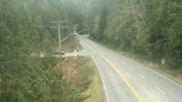
Egmont › Juh: Highway 101 at - Road, south of Earls Cove on the Sunshine Coast, looking South
Stoneham-et-Tewkesbury › Severovýchod
Cochrane: 4-N View Road

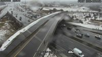
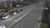
Old) Ottawa: The Glebe: Highway 417 near Bronson Avenue
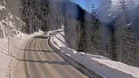
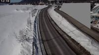
Canyon Creek › Východ: Highway 1 about 46 km east of Revelstoke, looking east
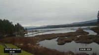
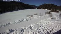
Area D › Východ: Sproat Lake Landing Resort
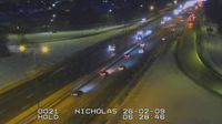
Old) Ottawa: Old Ottawa East: Highway 417 near Nicholas Street
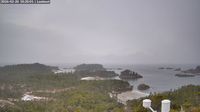
Britská Kolumbia: Calvert Island: West Beach Lookout
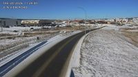
City of Langley › Východ: Highway 10 at 200 Street in Langley, looking east

Area C › Sever: Hwy 19 at Piercy Road, looking north
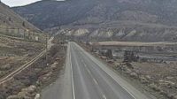
Spences Bridge › Sever: Highway 1 at the north end of - on the west side of the Thompson River, looking north
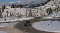
Radium Hot Springs › Sever: Highway 93/95 roundabout at - looking northbound on Highway 95

Pangniqtuuq › Severozápad: true
Avola › Sever: Highway 5 about 15 km south of - looking north
Carleton-sur-Mer
Upper Tantallon
Wood Buffalo › Severozápad: true
Webkamery poskytuje windy.com.
Pozrite si aktuálne počasie yr.no Kanada. Pre viacej informácií si zvoľte mesto. Zistite si predpoveď počasie pre mesto / obec v krajine Kanada.
© Copyryght 2026 onlineweather.online, Predpoveď počasia z yr.no, NRK, (Nórske počasie po slovensky) kontakt