Používaním stránok onlineweather.online súhlasíte s používaním cookies. Viac info OK

Kanada - Webkamery
 Počet webkamier:
Webkamery Kanada

Sable Island: Airport - Canada, Nova Scotia 3
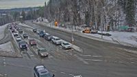
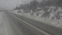
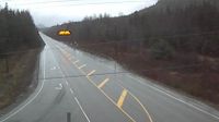
Prince George › Sever: Highway 97 at Highway 16 junction in - looking eastbound on Highway 16

Trois-Rivieres › Severovýchod: Airport - Quebec, Canada
Big Brook: St. Anthony Airport, Northeast View
Richmond: Seafair › Severozápad: true
Lake Cowichan › Západ: Highway 18 at Skutz Falls Road, looking west

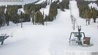
Petite-Riviere-Saint-Francois: Le Massif de Charlevoix
Fraser Valley Regional District › Sever: Highway 5 about 61 km south of Merritt, looking north
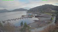
Campbell River: The Narrows Floating Restaurant - Brown's Bay Resort & Village - Seymour Narrows

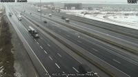
Old Toronto: South Core: Lake Shore Boulevard near Yonge Street
Area B › Sever: Highway 93 at Canada/USA border, looking north
Area C
Kitimat › Sever: Highway 37 about 5 km north of - at Oolichan Avenue, looking north
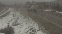
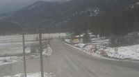
Thompson-Nicola Regional District › Sever: Highway 5 about 36 km south of Merritt at Larson Hill, looking north

L'Ile-d'Anticosti › Juhozápad: true
Meaford: Ontario 26 - Ontario 112
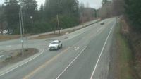
Sooke › Východ: Highway 14 at Lazzar Road near - looking east

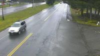
Chinatown: 5 Avenue - 1 Street SE
Webkamery poskytuje windy.com.
Pozrite si aktuálne počasie yr.no Kanada. Pre viacej informácií si zvoľte mesto. Zistite si predpoveď počasie pre mesto / obec v krajine Kanada.
© Copyryght 2026 onlineweather.online, Predpoveď počasia z yr.no, NRK, (Nórske počasie po slovensky) kontakt