Používaním stránok onlineweather.online súhlasíte s používaním cookies. Viac info OK

Kanada - Webkamery
 Počet webkamier:
Webkamery Kanada
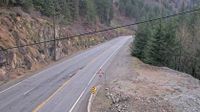
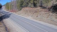
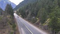
Boston Bar › Juh: Highway 1 about 3.5 km south of Hells Gate at Bradley Hill, looking south
Malakwa › Východ: Highway 1 east of Sicamous at Cambie Road/Solsqua Road, looking east
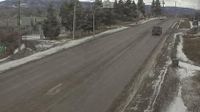
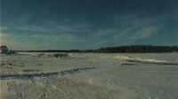
Burns Lake › Západ: Highway 16 at North Francois Highway in - looking west
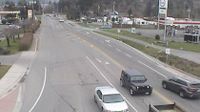
Chilliwack › Juh: Highway 1 at Prest Road in - looking south

Toronto: Martin Grove Rd At Eglinton Ave West
Area E › Sever: Highway 33 about 14 km north of Westbridge and 20 km south of Beaverdell, looking north
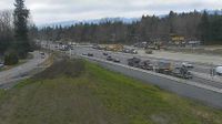
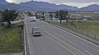
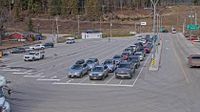
Abbotsford › Západ: 264 Street - Trans-Canada Highway
Area E › Juh: Highway 16 at Highway 37S on the border of Terrace and Thornhill, looking south
Huntsville › Sever: Highway 11 at Highway 141, Looking North
South Glengarry › Severozápad: true
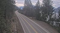
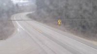
Regional Central Kootenay › Juh: Highway 3A about 1.6 km south of Sanca Creek Bridge, looking south
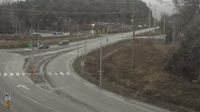
Procter › Sever: Balfour ferry terminal, looking north towards Highway 3A

Cap-Chat
North Cowichan › Západ: Highway 1 about 5 km north of Duncan at Herd Road/Cowichan Valley Highway, looking west
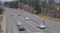
North Cowichan › Juh: Highway 1 about 5 km north of Duncan at Herd Road/Cowichan Valley Highway, looking south
Hope 1 › Juhozápad: Highway 7 about 2 km west of Hope, looking westbound
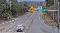
Central Saanich › Východ: Highway 17 at Mount Newton Cross Road, looking east
Juan de Fuca Electoral Area
Webkamery poskytuje windy.com.
Pozrite si aktuálne počasie yr.no Kanada. Pre viacej informácií si zvoľte mesto. Zistite si predpoveď počasie pre mesto / obec v krajine Kanada.
© Copyryght 2026 onlineweather.online, Predpoveď počasia z yr.no, NRK, (Nórske počasie po slovensky) kontakt