Používaním stránok onlineweather.online súhlasíte s používaním cookies. Viac info OK

Kanada - Webkamery
 Počet webkamier:
Webkamery Kanada
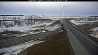
Area A › Sever: Highway 1 at Vowels Road next to Nanaimo Airport, looking north

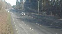
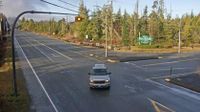
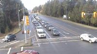
Duncan › Juh: Highway 1 at Trunk Road in - looking south
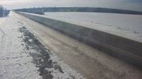
Unorganized Rainy River › Východ: Highway 11 near Highway 623, Looking East

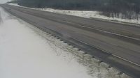
Southampton › Západ: Allenford - Ontario, Canada: Sauble River
Port Edward › Západ: Highway 16 about 34 km east of Prince Rupert near McNeil River at the Rainbow Summit chain-up area, looking west

Courtenay › Západ: Highway 19A at 17 Street Bridge in - looking west

View Royal › Severozápad
Terrace › Západ: Highway 16 at Highway 37S on the border of - and Thornhill, looking west

Courtenay › Juh: Highway 19A at 17 Street Bridge in - looking southbound on Comox Road

Valemount: Valemount Airport (CAH4)
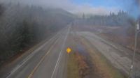
Flatbush: Hwy 44: South of Twp Road 654 near
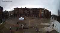
Revelstoke
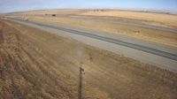
Parkland: Hwy 2: south of Nanton
Alert Bay › Západ: Highway 19 at Campbell Way in Port McNeill, looking west
Balgonie › Juhozápad
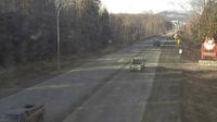
Courtenay › Západ: Intersection of Ryan Road and Lerwick Road in - looking west
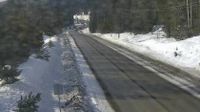
Invermere › Západ: Toby Creek Road at Panorama Fire Hall, near Springs Creek Road, looking west
Drayton Valley: Hwy 22 - Bridge
Webkamery poskytuje windy.com.
Pozrite si aktuálne počasie yr.no Kanada. Pre viacej informácií si zvoľte mesto. Zistite si predpoveď počasie pre mesto / obec v krajine Kanada.
© Copyryght 2026 onlineweather.online, Predpoveď počasia z yr.no, NRK, (Nórske počasie po slovensky) kontakt