Používaním stránok onlineweather.online súhlasíte s používaním cookies. Viac info OK

Kanada - Webkamery
 Počet webkamier:
Webkamery Kanada
Terrace › Východ: Highway 16 at Highway 37S on the border of - and Thornhill, looking east on Highway 16
Gibsons › Sever: Highway 101 at top of - Bypass at Stewart Road, looking north
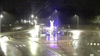
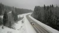
Area C › Juh

Squamish › Juh: Highway 99 about 12 km south of - looking south
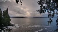
Area A: Koeye
Seguin Township › Západ: Highway 400 at Highway 518, Looking West
Merritt › Sever: Highway 5 about 15 km south of - at Comstock Road, looking north
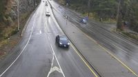
Whistler Resort Municipality › Východ: Highway 99 at Village Gate Boulevard in Whistler, looking east
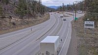
Kaleden › Sever: Highway 97 at Highway 3A junction just south of - Weigh Scale, looking north
Area A › Sever: Highway 1 at South Shawnigan Lake Road, looking north
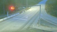
Princeton › Sever: Highway 3 about 32 km south of - looking north
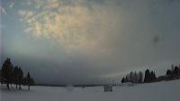
Slave Lake › Západ: true
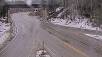
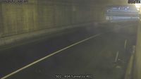
Big Eddy Settlement › Juh: Highway 1 at Highway 23 in Revelstoke, looking south to Highway 23
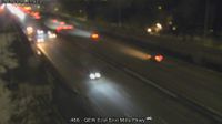
Mississauga: Erindale: QEW East of Erin Mills Parkway
Dease Lake: Airport E
Riviere-Koksoak: Canadian Royalties Nunavik Nickel
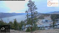
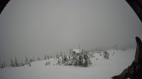
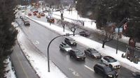
Kelowna › Sever
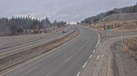
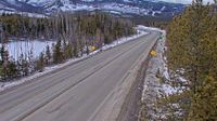
Valemount › Východ: Highway 16 about 27 km east of Tete-Jaune Junction and 40 km west of BC-Alberta border, looking east
Webkamery poskytuje windy.com.
Pozrite si aktuálne počasie yr.no Kanada. Pre viacej informácií si zvoľte mesto. Zistite si predpoveď počasie pre mesto / obec v krajine Kanada.
© Copyryght 2026 onlineweather.online, Predpoveď počasia z yr.no, NRK, (Nórske počasie po slovensky) kontakt